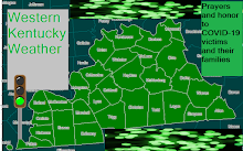
 Click on map to zoom in.
Placement of mesolows, Several MCS clusters, and the exact placement a timing of a warm front than a cold front make a low confidence severe wx and heavy rain forecast. Tomorrow will feature a low cape day but with dewpoints into the 60's there may be enough of an unstable environment for a MCS to produce damaging winds and isolated tornadoes mostly from late morning to mid afternoon, and north of a line from Smithland to Greenville Kentucky. In West KY another low confidence day of severe weather exists Friday and Friday Night but the SPC has highlighted a slight risk for the area.
Thursday's Day 2 slight risk runs from Greenville KY to Smithland KY line north.


No comments:
Post a Comment