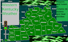
Most def still just as sig. Great winds and LLJ along with instability, lift, and moisture look good. The only con is cloudcover and precip may hurt us. Cloudcover may temper the threat somewhat but with this shear unlike TUesday it will not def even come close to trying to cancel the threat.
SUpercells will be poss. They will organize into a derecho that moves across West KY from 10pm-4am maype since i am starting to buy slower soultions maype more 4am-10am. Supercells should start around Fulton/ Mayfield around 4-5pm and continue. Isolated hailers may be poss overnight tonight and early tomm morning.
The GREATEST THREAT AREA IS JACKSON PURCHASE: including Ballard, Mccracken, Marshall, Calloway, Carlisie, Fulton, Hickman, and Graves counties. This looks to be a HIGH RISK type day here at least one EF-3 - EF-5 may be possible.
A Great threat exists across the Rest of West KY: A Strong tornado may be possible here mayype not quite as bad as far west KY
IN ALL WEST KY 22
- Damaging winds widespread 70-80 mph winds with local wind gusts up to 125 MPH
- Strong Tornadoes a super cell could be capable of an EF-3 + tornado ( Jackson Purchase looks like Ground Zero)
- Large Hail poss up to the size of Softballs in the strongest supercell.
Threat looks like most sig timeframe for West KY 22 is 5pm Thursday thu 4am Friday.
The threat should also be in at least NW Mid TN during this time and shift into Mid TN and last poss until late afternoon/early evening. Middle TN threat not quite as bad as West KY but could be bad though in some areas.
Wednesday, April 9, 2008
Subscribe to:
Post Comments (Atom)


No comments:
Post a Comment