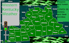
First of all this is what I call a stoplight map. Pretty much a call map, but I separate West KY into three areas. No Particular order each color represents will be discussed, and we will discuss how much and what type of winter precipitation will be expected. Also I can use this in heavy rain events, or any event where there you can split the Western Bluegrass into three pieces.
Green Light: Includes OWB(Owensboro) and HEN(Henderson) This area has the least confidence in big 6+ snowfall, but I am very confident that measurable snowfall will occur, and still especially southern portions can still locally get 6 or 7 inches with about 3-4 in the Henderson/Owensboro proper. The models have trended more precipitation more northward which is great for this area. Good thing here is all the precipitation is expected to be snow big questions up to the event will be how much moisture can reach, and therefore how much snow. Cold air will make for travel headaches, and serious problems cannot be ruled out south of US 60.
Yellow Light: Includes PAH(Paducah) and MADI(Madisonville) This area has good confidence in snowfall, and particularly heavy snowfall esp. along and south of the West KY Parkway. The Yellow Light Zone could see 5 to 7 inches of snow with local amounts of 9 or 10 along and south of West KY Parkway cannot be ruled out. Travel along the main road in the Yellow Light Zone the West KY Parkway from Paducah though Hopkins and Muhlenberg County can be very hazardous, and some rural roads may need to close. Some Blowing and Drifting of snow cannot be ruled out as winds increase.
Red Light: Includes HOP(Hopkinsville) FUL(Fulton) MUR(Murray) MAY(Mayfield) This area has a very serious situation on there hands. This will probably be the bullseye of the heaviest snow accumulations across Western Kentucky, and possibly the whole system during it's time in Eastern Arkansas, Kentucky, North Mississippi, Far North Alabama and Tennessee. The snow should start from Midnight-1am around Fulton and spread towards Hopkinsville and Elkton by daybreak. Some of the snow can be heavy, and bands of heavy snow cannot be ruled. If bands of heavier snow does occur I wouldn't be surprised to see a foot(12-13 inches occur). Many models, and trends are showing a pretty widespread chance for at least 6 inches across the whole red light zone. Sleet accumulation cannot be ruled out as well along the TN border, if a lot of sleet mixes in it may limit the great snow amounts, but could still make travel worse speaking of travel. Travel may become impossible Friday and early Saturday, and some road closures including even parts of US 68, the parkways, and maybe even I-24. So especially if you live in the Red Light Zone, and even the Yellow Light Zone do not travel unless it is an absolute emergency. Some blowing and drifting of snow cannot be ruled out either as winds increase.
Overall the worst impacts are on the Red Light Area. All of West KY should receive snow and several areas a lot of it. If you live in West KY or Mid TN or surrounding area prepare tonight because this could be a major storm.
If you do travel especially in the Red and Yellow Light Zones carry an emergency kit. More info can be found on these sites with NOAA, and the Red Cross.
http://www.redcross.org/portal/site/en/menuitem.1a019a978f421296e81ec89e43181aa0/?vgnextoid=9967c126fc9bf110VgnVCM10000089f0870aRCRD
http://www.nws.noaa.gov/om/winter/
Just be smart, and follow the safety rules and we can make it though this intense winter event safely. At least it won't be as bad from a power outage standpoint as Ice Storm 2009 or the 2008 Storms. Some areas may experience some power outage issues due to heavy snow though, but if you lose it the power should be on within 36 hours.
Green Light: 3-5 locally 6
Yellow Light: 5-7 locally 9
Red Light: 6-10 locally 12-13


No comments:
Post a Comment