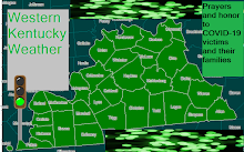
A severe threat exists again. It is hard to bust two in a row and this is a setup that also looks pretty good. You have a poss supercell threat followed by the an intense line or lines of storms. The timing appears amype after 5pm this can start. Squall Line timing should be 8 or 9pm along the MS river coutnies of West KY and clear Hopkinsville/Henderson and Owensburo area by 1 or 2am on Prom Day.
This line should also extend along Mid TN storms may form as early as early evneing along NW Mid TN. The main threat could be a squall line that forms around Midnight and storms that can produce damaging winds and isolated tornadoes.
In West Ky Damaging Winds in excess of 80 MPH, Large Hail, and Tornadoes some may be long tracked instablity and eventual timing of LLJ and with the seriousness of this event increased cant rule out a strong tornado either.
Right now all of West KY and even a deal of Mid TN can see severe weather biggest tornado threat appears to be farther west you go so the biggest tornado threat from around Mayfield and PAduach west with an respectable threat still remains across West KY particualry NW KY.
Thursday, May 1, 2008
Subscribe to:
Post Comments (Atom)


No comments:
Post a Comment